
Another week goes by and things have got interesting/puzzling. Back on Thursday 12th 2023, the Environment Agency, or at least it’s automated warning system (real live staff are engaged in industrial action), issued our first Flood Alert of the winter, saying that flooding was possible in the Salisbury Plain area. However, as you will see a little further on, not all is as it seems. Incidentally, whilst we are under a Flood Alert, this doesn’t apply to Berwick St James and point south. So, what has been going on in the aquifer over a week that began very dry and got progressively wetter?
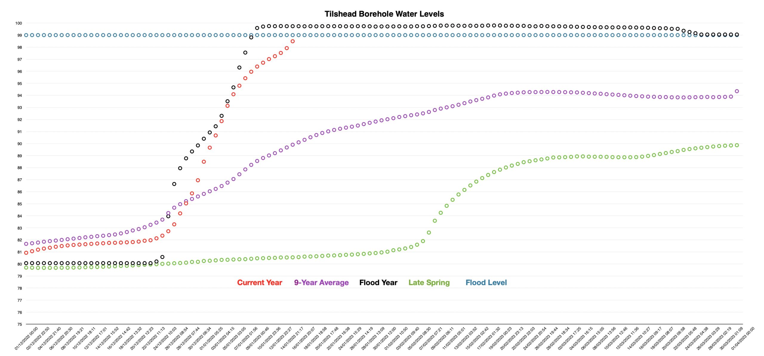
Well, that’s pretty much what you would expect. The rate of filling fell quite markedly to a fraction of that we had seen in the previous two weeks, then ticked sharply upwards following the rain we have had in the last 36 hours or so. However, the water level at 98.49 metres AOD is still within the Environment Agency’s “normal” range. So, the Tilshead borehole is a bit like Schrödinger’s famous cat (being simultaneously dead and alive). In our case, the aquifer level is simultaneously normal and abnormal. The alert will be justified in the next couple of days, with or without rain.
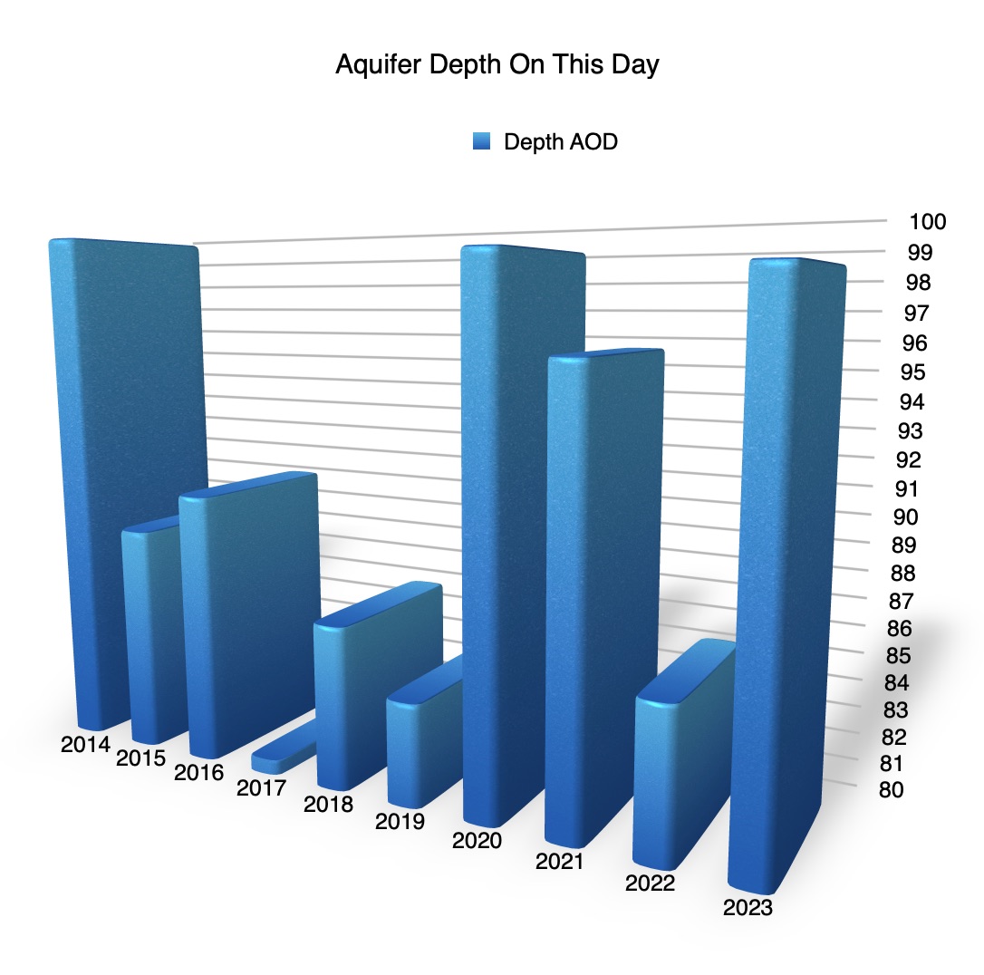
In terms of previous years on 15th January, the aquifer looks like this:
The river is also doing a great Schrödinger’s Cat impression. The Environment Agency hasn’t yet declared a river-level flood for the Till and yet this morning, for the first time at a site other than the ford in the meadow, it had broken its banks. The Till has just crept onto Water Lane (aka Dryden Street, the footpath between Church Cottage and the turning to Spring Lane and Till Cottage. It has also broken its banks between White Cottage at Asserton and Berwick St James. So, the Till is simultaneously in flood and yet not in flood.
Last week, I was asked how much the Till had risen and I hadn’t got a particularly good answer. Then, like London buses, two good answers came along within a short space of time. Between last Sunday and yesterday, the river had risen exactly 1 Smith. The Smith is now the official unit of flooding at the bridge in Church Street and is the point at which Peter worries about whether his latest duck house will be swept off its foundations and meet the same fate as its predecessor, downstream. 1 Smith = 20cm (about 8inches).
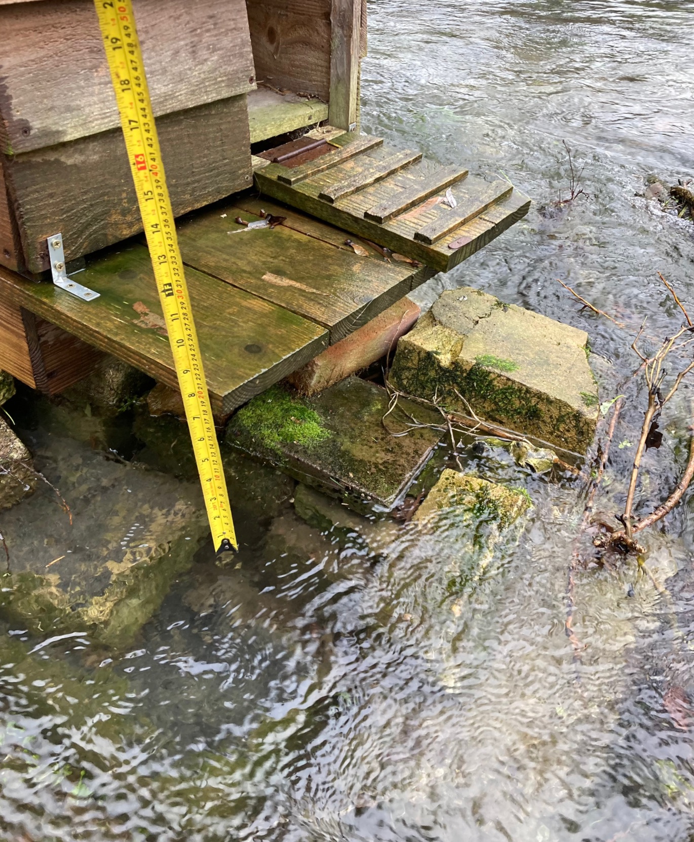
The duck house was moved to higher ground last week and is now safe. The other measure is the Sayer – a measure of the diameter of Mike Sayer’s gray water outfall into the river by the footbridge. 1 Sayer = 10cm = 4inches. Clearly, there are 2 Sayers to a Smith. In the last 24 hours, the river levels have risen another Sayer or half a Smith.
All joking aside, I was also asked where all the water is coming from and that isn’t a particularly easy question to answer. Groundwater is coming through the chalk and welling up through fissures (springs). It isn’t always clear where those fissures are and some odd things happen. Many years ago, before a new water treatment plant was put in what is now the Sayer’s garden, a test bore was sunk. That went down 10 feet with no sign of water. That was about 6ft below the then river level. Three weeks later, the JCB digging the hole for the tank hit water less than a foot below the surface and over a foot above the river level. On the whole, the groundwater flows from higher ground to lower ground, but it isn’t necessarily influenced by the land topography.
The origin of water running off the surrounding land into the Till is a bit of an easier question to answer; that is directly influenced by the land topography. The following map gives a very crude idea of where surface water might flow down dry valleys and into the spring-fed Till:
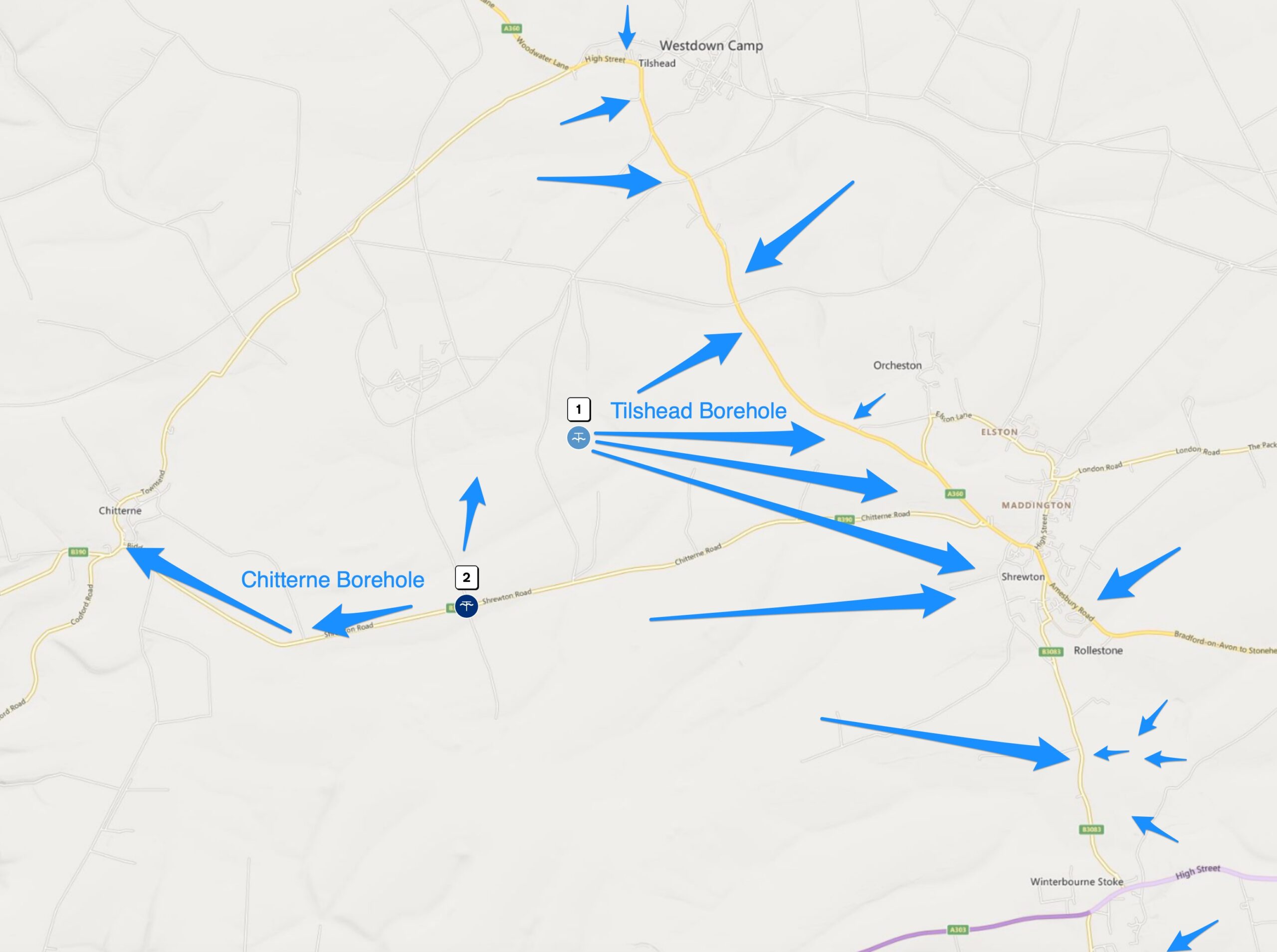
So, the first thing you’ll notice is that the Tilshead borehole is something of a misnomer. The Maddington or Shrewton Borehole would be a better description. Anyway, the map shows that most of the run-off contributing to the flow of the River Till comes from the western side of the river and most of it comes from the direction of the borehole. South of Shrewton, a little more flows in from the east, but the greatest contribution flows in from the direction of Parsonage Down. South of the A303 and down to Stapleford, the major influence is the ridge running down the eastern side of the Till from Oatlands Hill, through Horse Down and beyond. You will also see how close the Chitterne borehole is to the Tilshead borehole. The Chitterne catchment may also contribute some runoff into the Tilshead catchment, but that is a relatively minor flow. The vast majority of the surface water will go westwards towards Chitterne and the Codford Brook.
Enough waffle. What about the weather in the week to come? Well, today is likely to be largely fine, though we could have wintry showers during daylight. There is possibly more rain overnight, but it isn’t clear how much, as the weather system could remain in or around the Channel. If it tracks north, we could have a bit of sleet or snow by morning and that will continue until lunchtime on Monday. The rest of the week is, thankfully, looking pretty dry, but it will take a few days to impact the aquifer or the river.
Wet weather seems likely to return by the weekend, though it is far from clear whether this will be anything more than intermittent showers. More wet and windy weather seems to be the situation for the end of January into early February with temperatures largely near, or above, normal.