
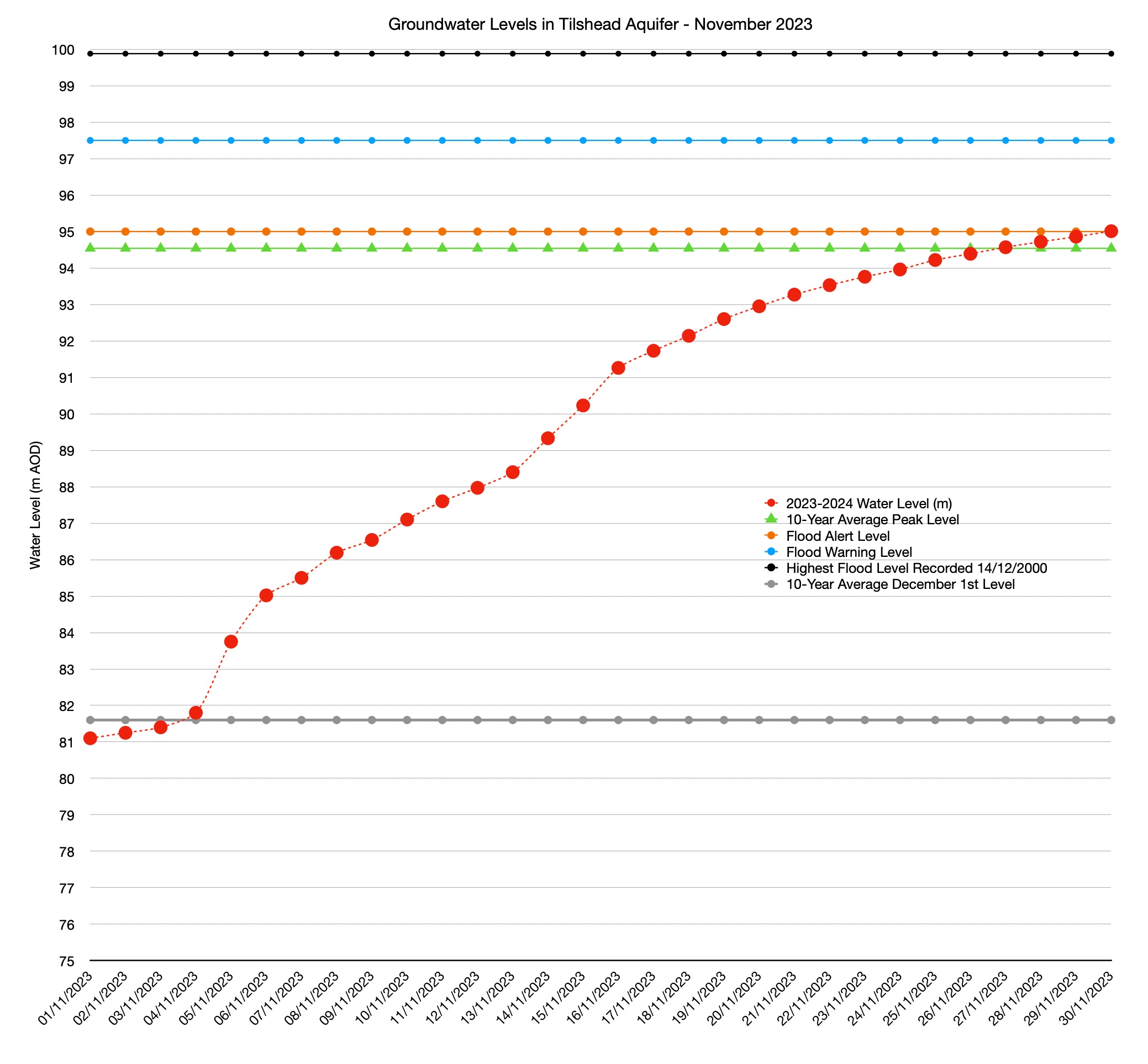
Today is the first day of meteorological winter and that was the original reason for starting to record flood data from December 1st for the Tilshead borehole and its impact on the River Till. The river is a winterbourne that is fed, primarily, from water from springs emerging from the Tilshead aquifer. The secondary source is run-off from the ground surface into the valleys that merge into the Till valley on its way southwards. These can cause groundwater flooding and surface flooding. They are related and interconnected, but the relationship is not straightforward. As a consequence, the Environment Agency issues two types of flood alert and warning for the village; those related to the groundwater level and those relating to the River Till as part of the wider Avon river system. Unfortunately, the nature of the aquifer means that there is only a 2.5 metre difference between a flood alert being issued and a few properties in the village suffering from groundwater flooding (blue line) when a Flood Warning might be issued. At this time of year, such a rise can happen in a matter of 3-4 hours and we have seen many too times over the last decade that alerts and warnings are issued after the event; last winter being a fairly typical example of that.
This is what happened throughout November. At the start of the month, groundwater levels (red line) were already a month ahead of what we see in an average year. On the 27th of November, groundwater levels hit the 10-year average peak level (green line) for the entire winter. That normally happens around the third week of February. Yesterday evening we hit the Environment Agencies trigger level (orange line) for a Flood Alert, but at the time of writing, no alert has been issued. The graph also shows something else. During the heavy rain at the start of November, water levels rose 2.5 metres between the 4th and 6th of the month and 5 metres between the 4th and the 10th. Things can change very quickly.
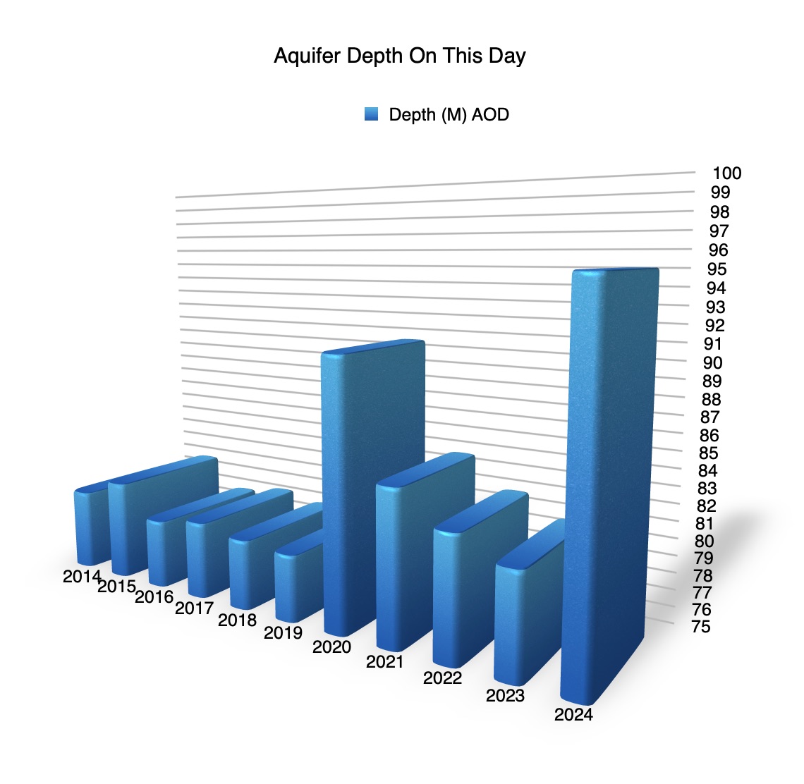
The next graph looks at the raw data underlying the average depth over the last decade. This year, levels are as far above the second-highest level of 90m in 2020 as they are below the highest ever level recorded on 14th December 2000. It seems hopeful that we won’t match that this year, but it is still too early to be certain.
The weather over the next few days looks likely to be dry, though there may be some wintry showers on Sunday. Beyond that the weather seems to warm up a little and that brings the prospect of more in the way of wintry showers and rain. This murky weather seems set to continue until the middle of the month with windier and wetter than average conditions taking us through the Christmas period and on towards the end of the year.